
Hiking Gambier Island's Mount Killam
Incredible ocean and island views on BC's Sunshine Coast

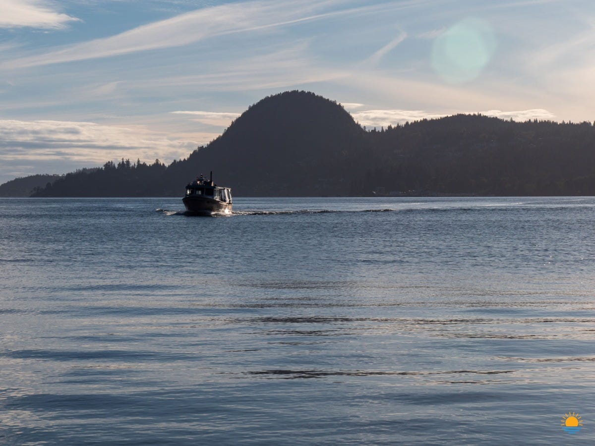
I recently hiked Mount Killam on Gambier Island with my friend Donna. Our journey starts from the BC Ferries Langdale ferry terminal. If you’re visiting from West Vancouver (or beyond), the Langdale ferry terminal is where you’ll arrive on the Sunshine Coast. It’s the same terminal that the big boats use but today, we’ll hop onto the small passenger ferry for the short ride to Gambier Island.

It’s an overcast morning as we set out. From our spot on the passenger ferry, we see the larger ferry making its way from Horseshoe Bay to the Sunshine Coast. We arrive on Gambier Island and disembark and then the ferry loads passengers for its return trip back to the mainland.

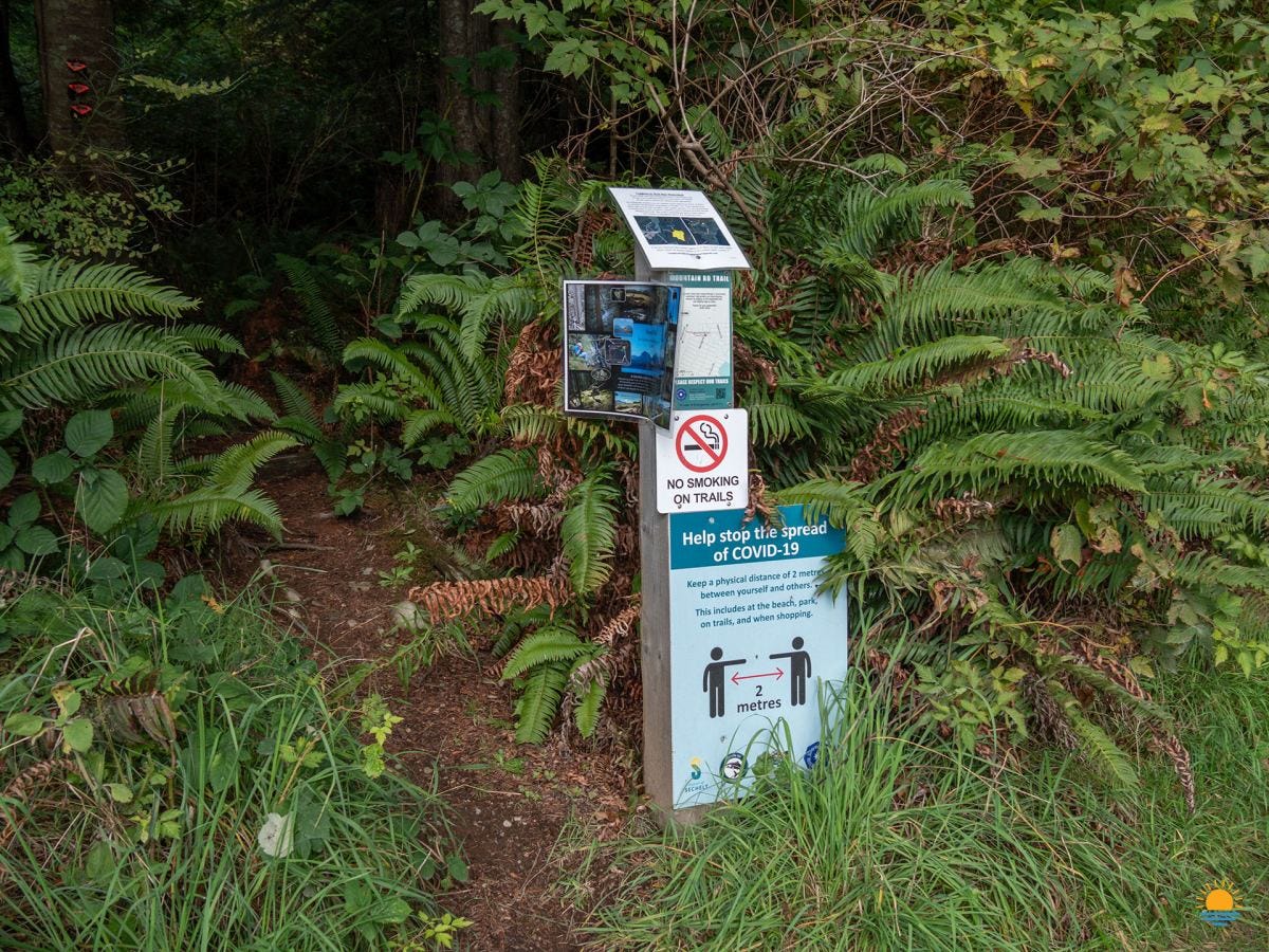
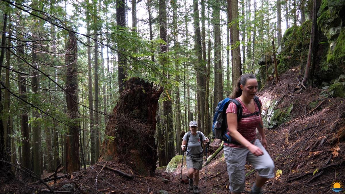
Our trek starts with a half-hour walk on the quiet island road before turning into the trail. The forested surroundings are beautiful and there’s instantly lots to see! We find this darling squirrel eating away and soon after, we spot a colourful woodpecker. We continue to follow the leaf-marked path that takes us through gorgeous rainforest.

The trail to the top of Mount Killam
There are a couple of ways to get up Mount Killam. In a previous Mount Killam video, we take a different path for the first part of the trail. The first part of the trail that we follow today isn’t something I’ve recorded before. We’ll follow this new-to-you path for half-an-hour before we reach junction where we connect with the other trail.
We have a quick snack before heading up for the last one-and-a-half hour hike up. This is where the uphill starts and it’s a bit of a push! I’m tired! We periodically take mini breaks. I’m disappointed in my lack of fitness but Donna does just fine (as usual).
Spectacular views from atop Mount Killam
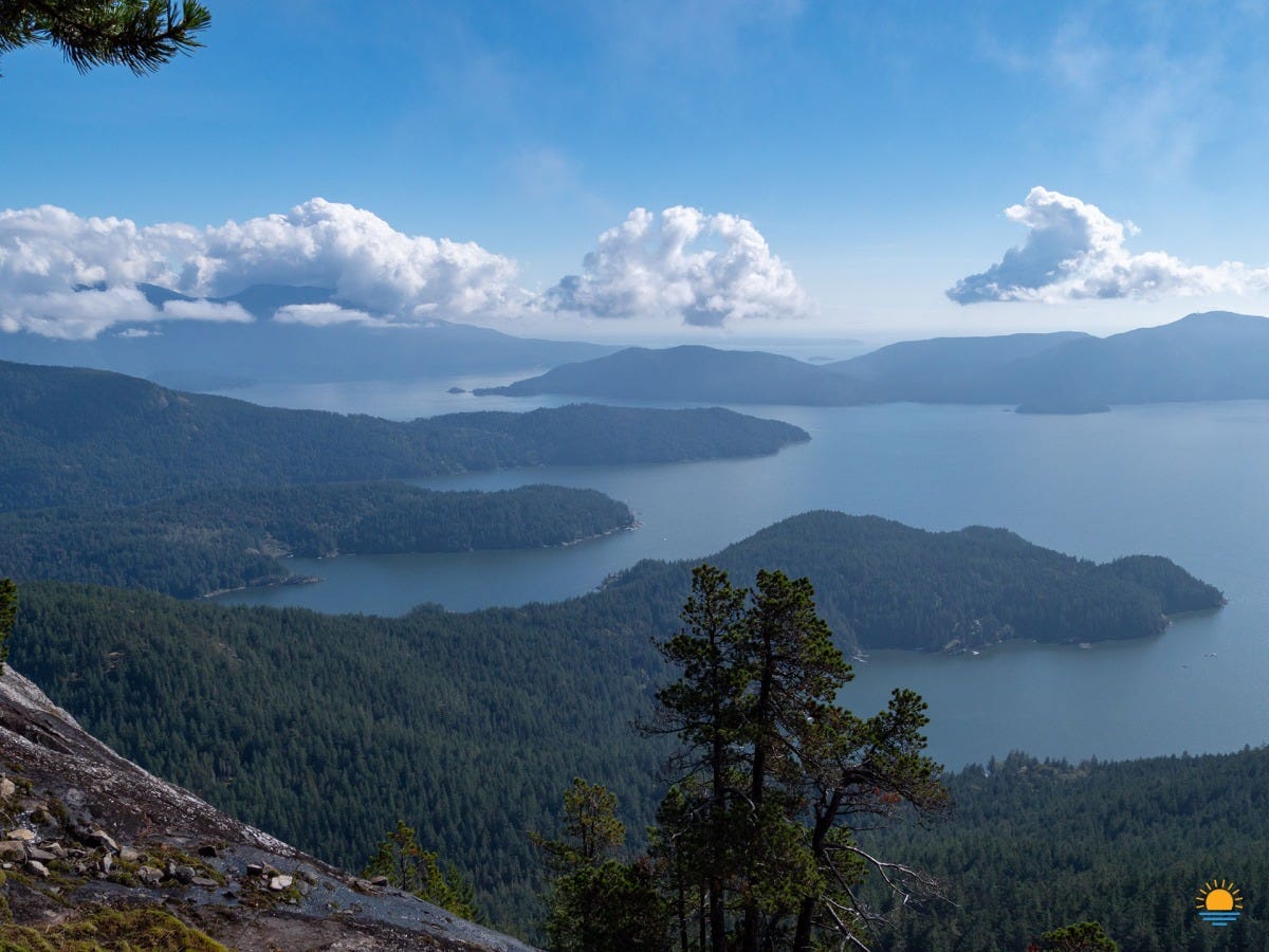
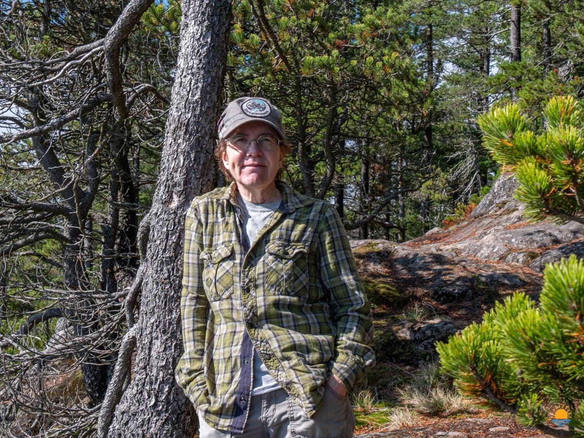
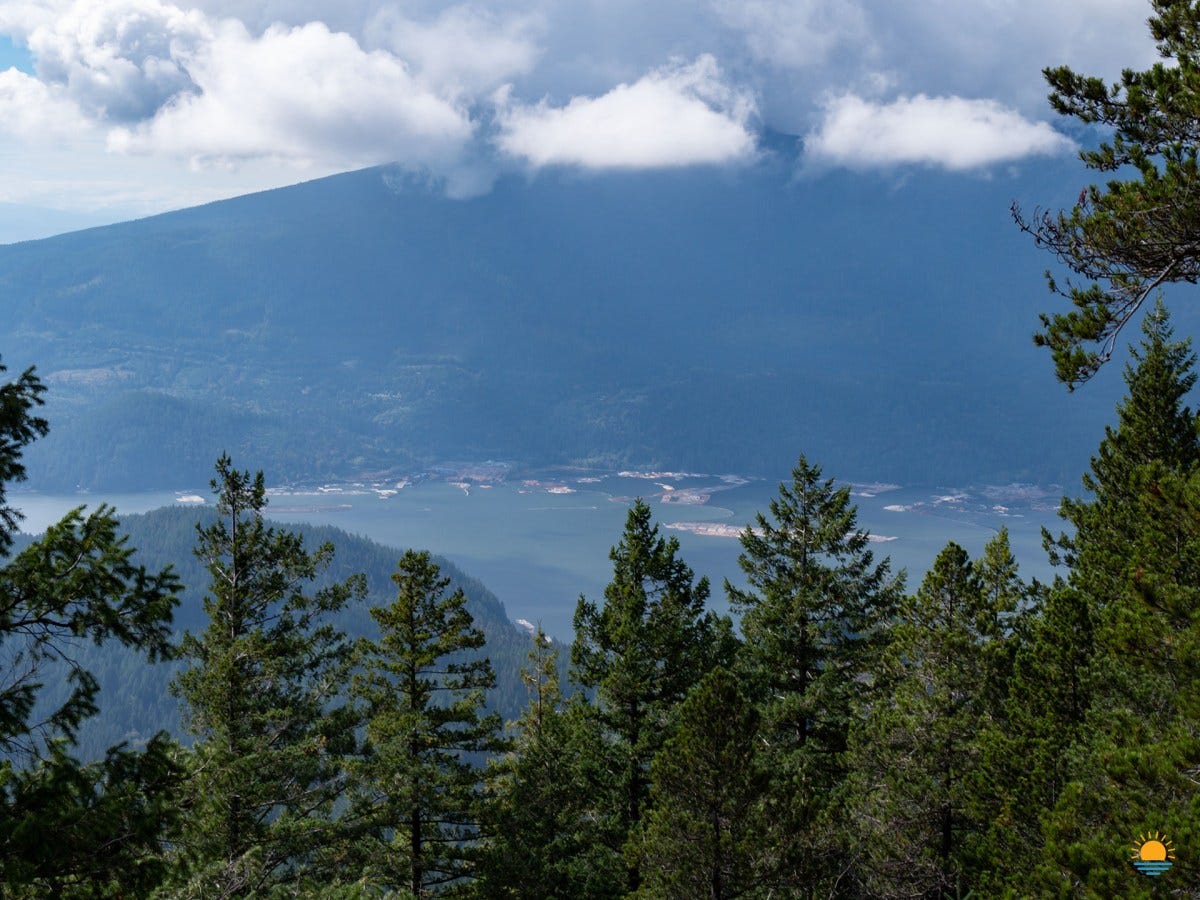
By the time we arrive at the lookout point, we are very much ready for a sit-down-lunch-break. We could hike up a little higher and closer to the top of Mount Killam but this is the best spot to stop and appreciate the amazing views! You can see forever! The North Shore Mountains were a little bit in the clouds but we can see Bowen Island and Keats Island and, of course, Gambier Island below us. In the distance is the Sunshine Coast, the gap in Gibsons, ferries out in the distance, and even Vancouver Island. Turning and looking the other direction, we also see Port Mellon.
Donna provided a point-form review of our hike to this point:
Cool breeze.
Definitely fall.
Hazy.
Worth it.
Muddy in places but that’s OK.
The downhill hike
We’re on our way down. The downhill is the easy part of every hike but we still have to be careful because it’s easy to get a little tired and make a mistake. You have to stay alert and make sure you don’t slip. It’s pretty wet today so there’s a lot of opportunity to fall and get hurt. Despite our cautious pace, we know we’re on a bit of a schedule as we want to make the ferry at the bottom. Hopefully we make it on time.
I stop at a little mossy section to set up the camera for some footage for my video. I don’t get very far before it decides to tumble from its spot! Oh, well - Forget about that idea. At least the moss provided a soft landing and the camera is OK.
Back at New Brighton
We arrive at the dock plenty early to make the first ferry. Our brisk downhill pace served us well as a line soon forms behind us. Some of those people will have to wait for the second ferry run back to Langdale.
When we get back to the big BC Ferries terminal in Langdale, Donna’s sweetie is there to meet her. Paul didn’t meet me because he was at home preparing a hot delicious meal! That’s my kind of welcome!
That’s the end of this story. See you in the next one!
Thanks for reading…
~Val
I've hiked this one before! Watch my original hiking Mount Killam video from July 2016.
More views from atop Mount Killam


Connect with Val & Paul

We're Val and Paul and we're a married couple who live on BC's Sunshine Coast! We moved from Alberta to Gibsons in 2014 and love our life on Canada's West Coast! Subscribe to our YouTube channel and email newsletter and you'll learn what it's like to live in the most beautiful place in Canada.